 |
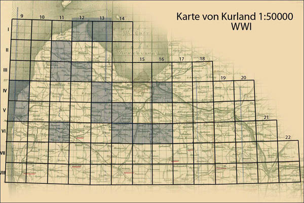
Chapter of First World War era German maps in scale 1:50000 Karte von Kurland (Kurland map) was revised and supplemented by new information. Maps from this set cover big part of Latvia and the northern territory of Lithuania. Also updated description of WWI period German maps in scale 1:25000 Russischen karte des Westlichen Grenzgebiets (Russian map of western frontier). |