Lituania map in scale 1:400000, 1933 (example, link)
Map in scale 1:400000 prepared and published by Military Topography department of MoD Lithuania in 1933. Great work on this map was done by head of Military Topography department - Col. Antanas Krikščiūnas. Most important on this map in scale 1:400000: it was shown all territory of ethnographic Lithuania, it was standardized all names of objects (populated places, rivers, lakes). Map in scale 1:400000 consists of 2 sheets (summary size 100x95 cm). It was published 5 different variants of map in scale 1:400000:
- A edition map published in 5 colors. Relief shown by coloring.
- B edition map bublished in 5 colors. Relief shown by horizontals. Other content as in A variant.
- C edition as B, relief was not shown. (4 colors edition).
- D edition as B, relief and woods not shown (3 color edition);
- E edition map published in 2 colors, shown only hidrographic elements and relief (by horizontals).
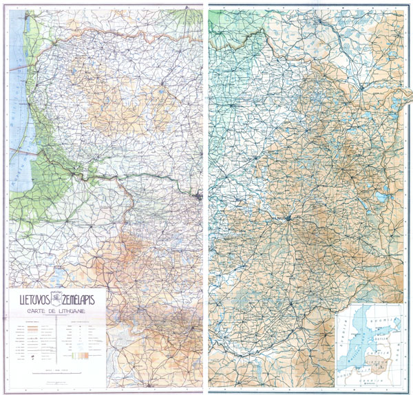
General view of Lithuania map in scale 1:400000 (1933), variant A
Short description (in FR and LT) of maps in scale 1:400000 you can found at http://maps4u.lt/en/maps.php?img=KAM_Kariuomenes_stabo_karo_TS_leidiniu_katalogas&w=600&h=400&cat=14