|
Reichkommissar fur das Ostland, Ostland Atlas, Riga 1942.
The Ostland Atlas and Statistical Report collection includes the two reports that make up the Strukturbericht uber das Ostland (Structural Report on the Ostland), the Ostland Atlas, and the Ostland in Zahlen (Ostland in Numbers). This report was created by the Nazi Reich Commissioner for the Eastern Territories and used in the civil administration of the occupied Eastern Territories, or Estonia, Latvia and Lithuania.
The Ostland Atlas features 52 color maps from a rare atlas published 1942. The maps show the occupied administrative territories, its climate and vegetation, population demographics, agricultural status, industry, energy and economic features, traffic and roads, foreign trade in 1938, and the history of the area to 1943.
Ostland in Zahlen is a statistical report on the Ostland also published in 1942. The report covers five main topics: region, population, economy, culture, and healthcare/social security.
(According Ball State University Library)
Our collection has all 52 digitalized (400 dpi) maps from Ostland atlas, description of atlas (Ostland Atlas, Teil II, pdf) and Statistical Report (Ostland in zahlen, Teil I, pdf).
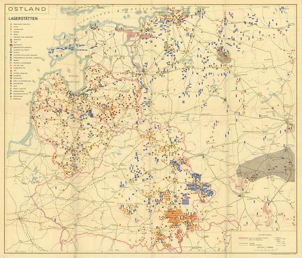
5-th map from Ostland atlas- Minerals.
|
|
Karte von den Koniglich Preussischen Staaten und dem Herzogthume Warschau
Full name of collection: "Karte von den Koniglich Preussischen Staaten und dem Herzogthume Warschau. Nach dem Friedensschlusse vom 9-ten July 1807, entworfen von H.H.Gottholdt . Berlin 1808".
Scale of maps is appr. 1:1200000. Size of maps 27x20 cm.
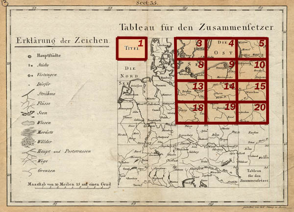
Index sheet:
|
|
Neueste Karte von ganz Preussen und Herzogthum Warschau
Set of 12 (twelve) maps published in 1809 by Sotzmann, Daniel Friedrich named "Neueste Karte von ganz Preussen und Herzogthum Warschau: mit dem grosten teiil von Sachsen das Herzogthum Meklenburg und Schwedisch Pommern nebst dem angranzenden Oesterreichischen und Russischen Antheil von Polen. Nach den neuesten geographischen Bestimungen und Berichtigungen und mit Benutzung der grossen Karte von Chauchard von Deutschland. Dann der Karte von Sotzman, Gilly, Schroder, von Textor, Metzburg und Rizzi Zanoni bearbeitet, dann mit allen neuen Unter Abtheillungen der Provinzen, so wie mit allen Strassen und Weegen eingerichtet". This set is on territories Prussia, Duchy of Warsaw, biggest part of Saxony, Duchy of Meklenburg, Swedish Pomeranian, Russian and Prussian part of Poland. Colored maps have size 60x80 cm. Maps were prepared using newest Sotzmann's, von Textor's, Schroder's, Gilly's, Matzburg's and Rizzi zanoni's maps.
|
|
Atlas von Liefland und Ehstland ... 1798
Earl L.A. Mellin in 1791-1798 published atlas entitled "Altas von Liefland oder von den beyden Gouvernementern U. Herzogthumern Lief-und Ehstland und der provinz Oesel ..." (French name of the atlas "Atlas de la Livonie ou des deux Gouvernemens et Duches de Livonie et d'Esthonie, avec la Province d'Oesel ...") on current territory of Estonia and part of Latvia. Atlas consists of the overview map, 14 maps of administrative units (Kreis), title page and description. Scale of the atlas 1:190000-1:200000, size sheets 55x80 cm. On pages is drawn grid, longitude is considered from Ferro.
|
|
Geognostic (geological map prototype) map of Germany and adjacent countries on 42 sheets, 1826, 1:1100000
Geognostic (geological map prototype) map of Germany and adjacent countries on 42 sheets (original name in German - Geognostische Karte von Deutschland und den umliegenden Staaten in 42 Blättern nach den vorzüglichsten mitgetheilen Materialien) published in Berlin in 1826. As mentioned set consists of 42 maps in scale 1:1100000. Autors Leopold von Buch, Friedrich Rudolph von Rothenburg, Heinrich Kliewer, Carl Jättnig, Paulus Schmidt. Publisher - Simon Schropp & Comp. Colored maps have dimension 25 x 18 cm.
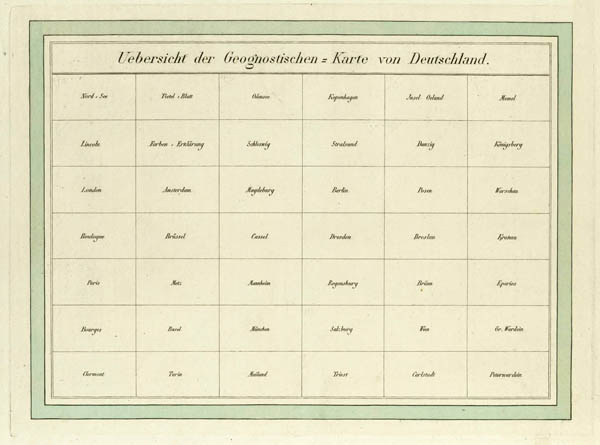
Index of Geognostic (geological map prototype) map of Germany and adjacent countries on 42 sheets, 1826
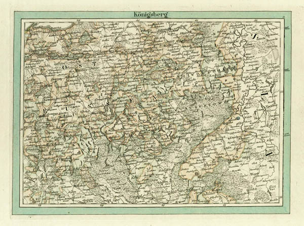
Map Königsberg from set Geognostic (geological map prototype) map of Germany and adjacent countries, 1826 (general view)
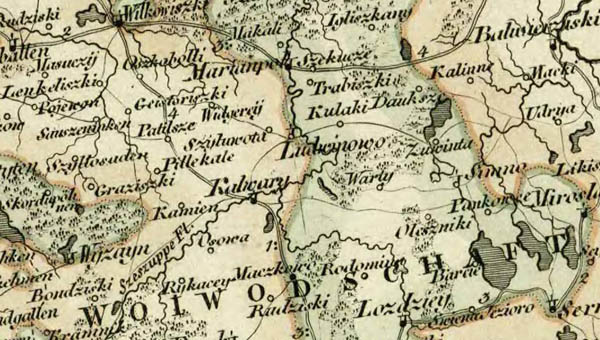
Fragment of map Königsberg from set Geognostic (geological map prototype) map of Germany and adjacent countries, 1826 (part of Lithuania)
|
|

