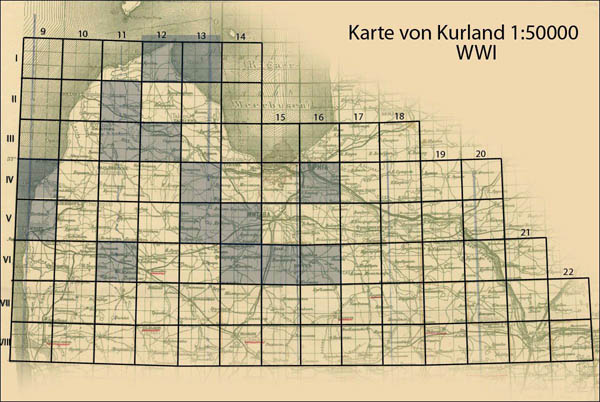
Map of Curonia in scale 1:50000 (karte von Kurland 1:50000), index (link)
During First World War German topographers prepared and published map on terrirories of part of present Latvia - Curonia in scale 1:50000. This set had original name Karte von Kurland 1:50000. Set covers also territories of north Lithuania (see index).

Index of German maps from set Karte von Kurland 1:50000 on territories of Latvia and North Lithuania (maps marked in blue were digitalized)
Maps from set Karte von Kurland 1:50000 during WWI were prepared by German topographers using Russian 1, 2 verst maps (1:42000, 1:84000) of Russian Empire. Content on maps Karte von Kurland 1:50000 identic to 1, 2-verst maps of Russian Empire, but some place-names on maps from set Karte von Kurland 1:50000 were in German. Maps are named as Russian 2-verst maps by 2 numbers: first number (Roman) shows row, second number (Arabic) shows position of map in row, additionally maps named by name of biggest populated-place on map. Example of name: III-12 Talsen. Size of each map 15′ latitude x 27′ longitude, longitude was considered from Pulkovo (size of map - 55 x 57 cm). On frames name of map, set, publisher, year of publishing, scale were given.

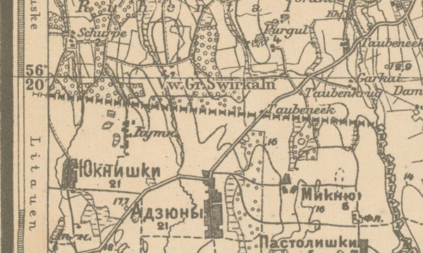
Fragment of map VI-16 Bauske from set Karte von Kurland 1:50000 (1917, showing border between Lithuania and Latvia), it is interesting that before 1917 name of nation Lithuania (in German Litauen) on this map was given

