|
|
| Merry Christmas and Happy New Year |
 |
Merry Christmas and Happy New Year, dear maps4u.lt visitors! Priecīgus Ziemassvētkus un laimīgu Jauno gadu! Wesołych świąt i szczęśliwego Nowego Roku! Rõõmsaid Jõule ja Head Uut Aastat! |
|
· admin on 2014-12-24 09:05:46 ·
Read More ·
2310 Reads ·

|
|
| Soviet maps in scale 1:10000 |
 |
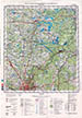
Chapter of Soviet maps in scale 1:10000 (1cm. on map - 100 m. on terrain) was supplemented by new information about maps S1:10000 showing biggest cities (Vilnius, Kaunas, Klaipėda, Šiauliai, Panevėžys) of Lithuania. In case of mislead [opponents and owns] maps prepared in local coordinate system, military and strategic [important] objects were not shown or were distorted. |
|
· admin on 2014-12-20 12:58:44
Read More ·
2345 Reads ·
|
| Administrative divisions of inter-war Lithuania |
 |
Courtesy XrysD chapter of Inter-war Lithuania maps was supplemented by maps showing administrative divisions of inter-war Lithuania into counties (apskritis) and townships (Valsčius) acording inventory from 17.10.1923. |
|
· admin on 2014-11-15 20:26:51
Read More ·
2404 Reads ·
|
| RKKA maps in scale 1:25000 |
 |
Courtesy easteurotopo.org we updated chapter of RKKA 1:25000 maps. RKKA maps in scale 1:25000 on territory of Lithuania by RKKA topographers were made using German TK25, Lithuanian 1:25000 maps by updating content using newest cartographic material.
|
|
· admin on 2014-11-08 21:35:34
Read More ·
2263 Reads ·
|
| Military topographical map of European Russia (1:126000) |
 |
New information and maps supplemented chapter of Military topographic map of European Russia (in orig. Военно-топографическая карта Европейской России, scale 3-verst per inch/1:126000). This map by RKKA topographers was republished till WWII (with some updates). |
|
· admin on 2014-10-16 20:49:27
Read More ·
2318 Reads ·
|
| City Kaunas on plans and maps |
 |
Chapter-virtual exhibition City Kaunas on plans and maps was supplemented by new plans (XVIII c.) and German, Russian, Lithuanian topographic maps from beginning XX c. All plans and maps at this chapter presented in full size. |
|
· admin on 2014-10-11 15:17:18
Read More ·
2252 Reads ·
|
|
 |
| 23 AUG 2014 |
 |
Chapter (virtual exhibition) City Kaunas on plans and maps was supplemented by new maps and plans showing Kaunas ir XVIII century. All plans presented in full size. |
|
· admin on 2014-08-23 11:09:49
Read More ·
2152 Reads ·
|
| 29 JUL 2014 |
 |
New maps and information supplemented chapter of 10-verst map of Russian Empire (1:420000, set Special map of Russian Empire created leading by general Strelbickij). It is interesting that 10-verst maps were published even till WWII, maps covered biggest part of Europa. |
|
· admin on 2014-07-29 21:57:41
Read More ·
2080 Reads ·
|
| 14 JUL 2014 |
 |
In separate chapter we presenting Soviet maps in scale 1:200000 (1cm.-2km., 1945-1991). 24 maps in scale 1:200000 covering also territory of Lithuania. It is interesting that using soviet S1:200000 maps were released first Lithuanian maps in scale 1:200000 (1994-1995). |
|
· admin on 2014-07-14 20:52:49
Read More ·
2162 Reads ·
|
|
|
|
|
Not a member yet? Click here to register.
Forgotten your password? Request a new one here.
|
|