Also was inter. variant: all content (except relief) was transferred from verst-scale maps, relief was treansferred from Reymann's maps (by some changes, see below examples).
All after-First-war KdWR maps (1918-1923) published by private publishers (in case of Latvia(?), Lithuania, Poland booking) were compiled only from verst-scale maps.
Also maps from rows 39-41 were prepared using Austrian maps, similarly German maps in scale 1:100000 (KdDR) were used (border of KdWR set).
In literature the following types of maps from collection Karte des Westlichen Russlands (Map of Western Russia) noticed.
Type Ia - content of the map shown in black (conventional signs and symbols) and relef presented by brown contour lines. Maps of this type are prepared using 2-verst maps of the Russian Empire
An example of the type Ia - map N16 Skajzgiry, 1915
An example of the type Ia - map N16 Skajzgiry, 1915 (fragment)
As a variation on this type maps - maps where displayed only the territory of the Russian Empire, the territory of other countries - white field.
An example of the type Ia map where displayed only the territory of the Russian Empire - map J18 Korciany
An example of the type Ia map where displayed only the territory of the Russian Empire - map J18 Korciany (fragment)
After the First World War, the Polish Military Institute (WIG) in the early years reprinted maps from set KdWR, but due to poor printing on maps all content (including horizontals) was displayed in black.
Example map drom set KdWR published by WIG - map R27 Nowogrodek, 1921 (general view)
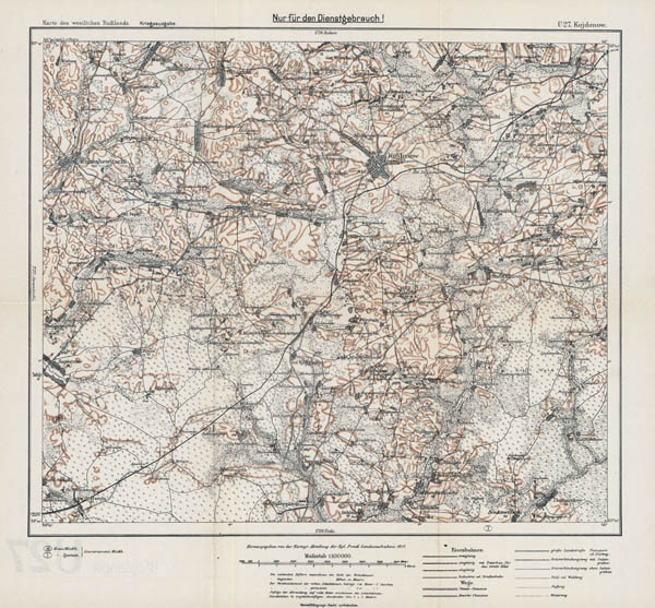
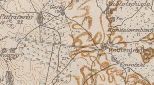
Type Ib - content of the map shown in black (conventional signs and symbols) and relef displayed by brown broad lines. Typically, these maps are found in the columns of S, T, U (eastern area).
An example of the type Ib map - map U27 Kojdonow, 1917
An example of the type Ib map - map U27 Kojdonow, 1917 (fragment)
There are maps which part are types Ia and Ib.
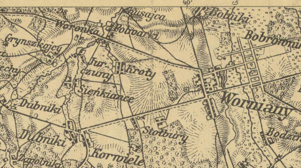
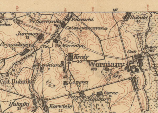
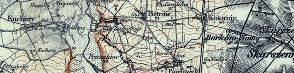
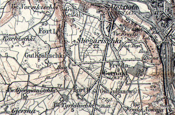
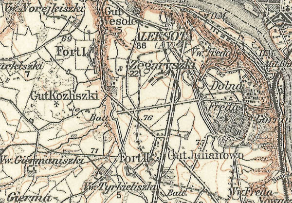
Example of map type Ia and Ib (mix) - map U23 Kurenjetz, 1917
Example of map type Ia and Ib (mix) - map U23 Kurenjetz, 1917 (fragment)
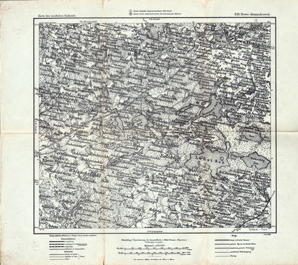
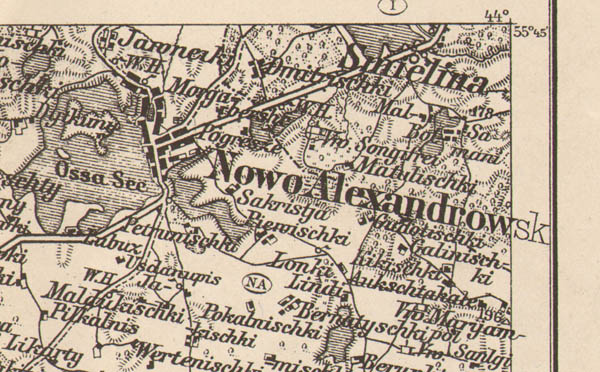
IIa type - all map content transferred from 1:200,000 scale maps, content of maps shown in black (conventional signs and symbols) and relef displayed by hatching.
An example of the type IIa map - map S19 Nowo-Alexandrowsk, 1915
An example of the type IIa map - map S19 Nowo-Alexandrowsk, 1915 (fragment)
Without having a single original cartographic material German cartographers preparing maps from set KdWR use 2-verst (1:84000) maps and 1:200,000 scale maps (mix). Below presented example- map combioned from maps of type Ia with an insert type IIa.
Example of map type Ia and IIa (mix) - map S18 Illukst, 1915
Example of map type Ia and IIa (mix) - map S18 Illukst, 1915 (fragment)
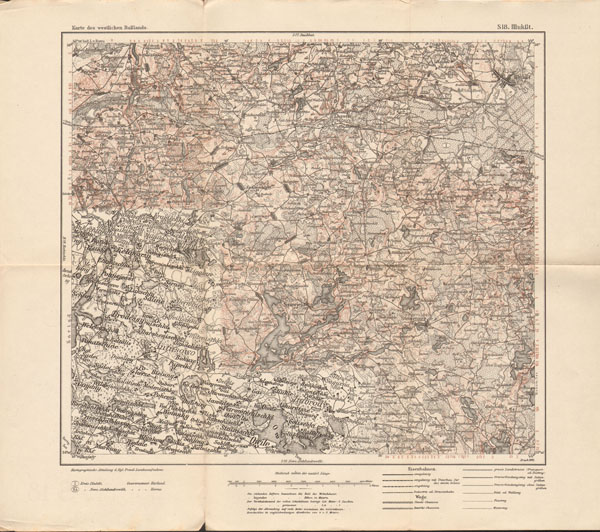
IIb type - all content transferred from the map of Germany (KDR) scale of 1:100,000. Map content displayed in black (conventional signs and symbols) and relef displayed by hatching in a scale Lehmann.
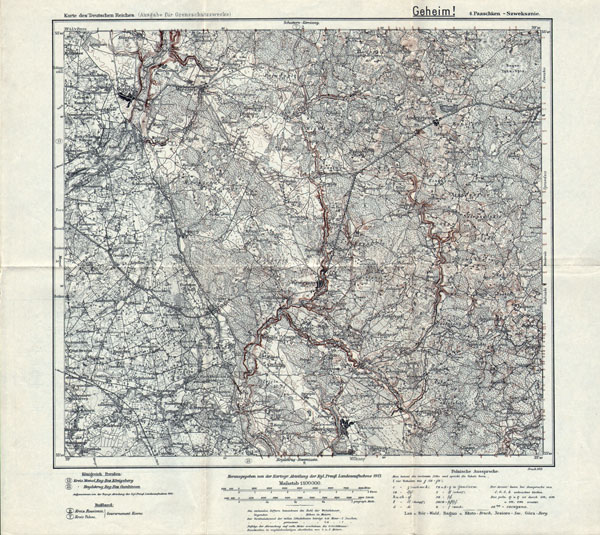
An example of the type IIb map - map J19 Paaschken - Szweksznie (or 4 map from set KdR), 1921
An example of the type IIb map - map J19 Paaschken - Szweksznie (or 4 map from set KdR), 1921 (fragment)
Mixed map, types Ia and IIb:
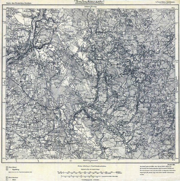
Example of map type Ia and IIb (mix) - map J19 Paaschken - Szweksznie (or 4 map from set KdR), 1913
Example of map type Ia and IIb (mix) - map J19 Paaschken - Szweksznie (or 4 map from set KdR), 1913 (fragment)
It is happen mixed map from Ia, IIa and IIb types:
Example map Ia, IIa and IIb types (mix) - map B34 Sobotka-Kalisz (or 351 map from set KdR), 1914
Example map Ia, IIa and IIb types (mix) - map B34 Sobotka-Kalisz (or 351 map from set KdR), 1914 (fragment)
Next selection to types of maps from set KdWR assigned only to maps that displays the Sea (usually in Estonia, Latvia, Lithuania).
Type III - maps on which the sea appears as a white spot.
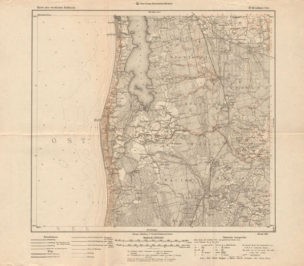
An example of a type III map - map H15 Libau (Nord), 1918
An example of a type III map - map H15 Libau (Nord), 1918 (fragment)
Type IV - maps on which sea appears as a white spot with isobaths (optional digits indicate the depth).
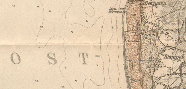
An example of the type IV maps - map H16 Libau (Süd), 1921
An example of the type IV maps - map H16 Libau (Süd), 1921 (fragment)
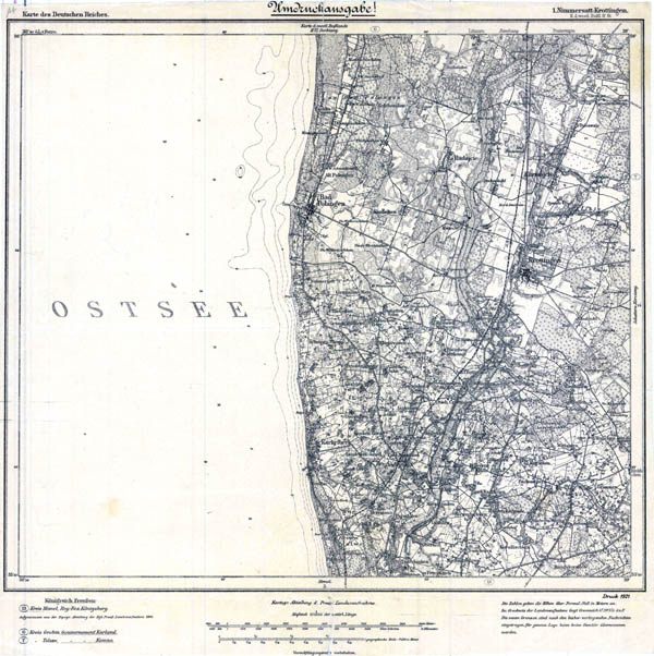
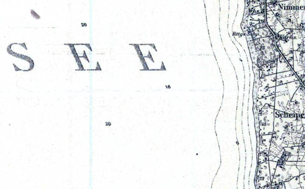
An example of the type IV maps - map H18 Nimmersatt - Krottingen, 1921 (or 1 map from set KDR)
An example of the type IV maps - map H18 Nimmersatt - Krottingen, 1921 (or 1 map from set KDR), fragment
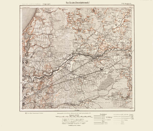
V type - maps on which the sea appears isobaths going parallel to the shore.
Example V-type map - map P13 Wangasch, 1917
Example V-type map - map P13 Wangasch, 1917 (fragment)
During I WW German topographers were made several editions of KdWR maps on the same territories (changes not always concerned replacing Reymann's insertions). On upgraded KdWR maps are some complements observed: new narrow railways, bunkers, walls were shown.